Design–build in Los Angeles. Concept, permitting, and construction under one roof.
00
Coachella Valley, CA
60 acres · ~170 homes · In development
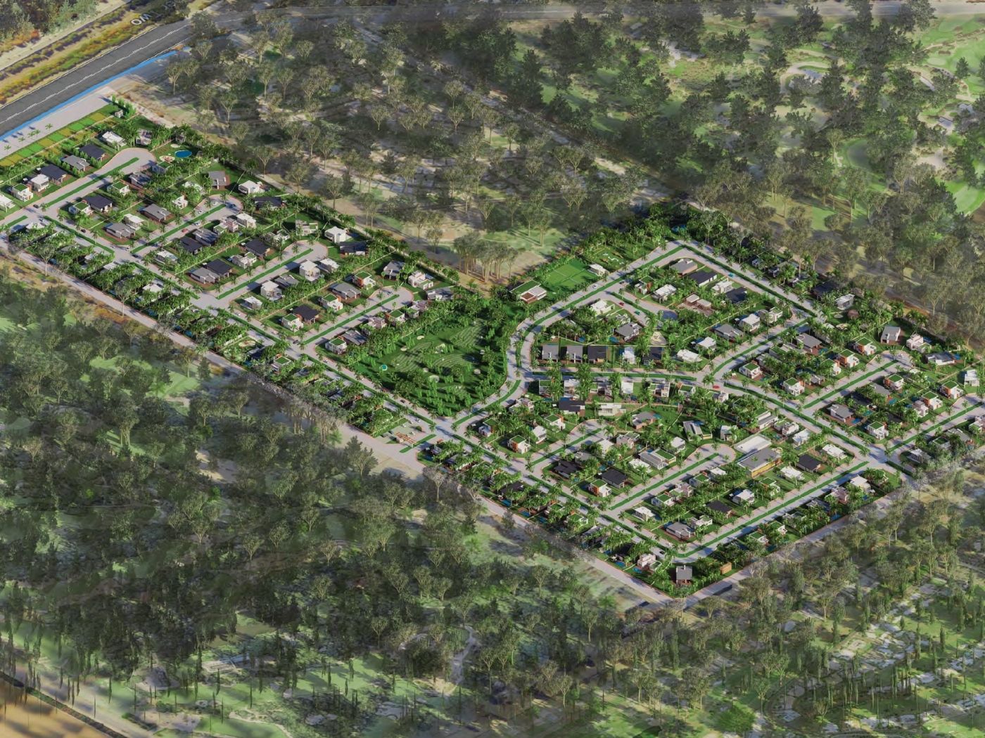
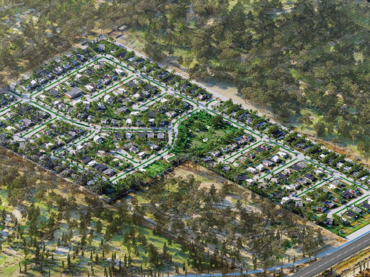
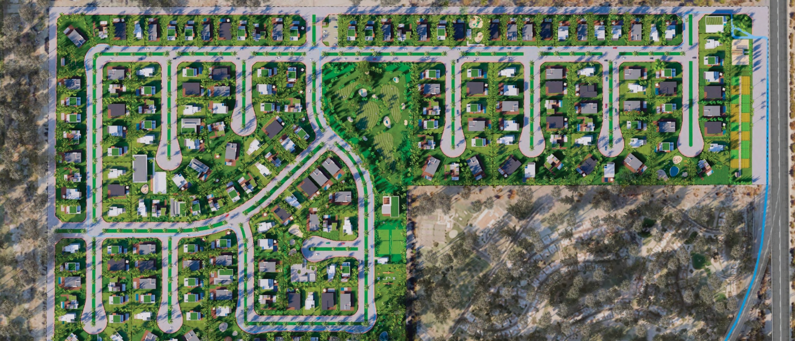
Nef Coachella Residences transforms a 60-acre site into a residential gated community of approximately 170 multi-family homes — villas and custom houses set among parks, trails, and shared amenities. Developed with NEF.
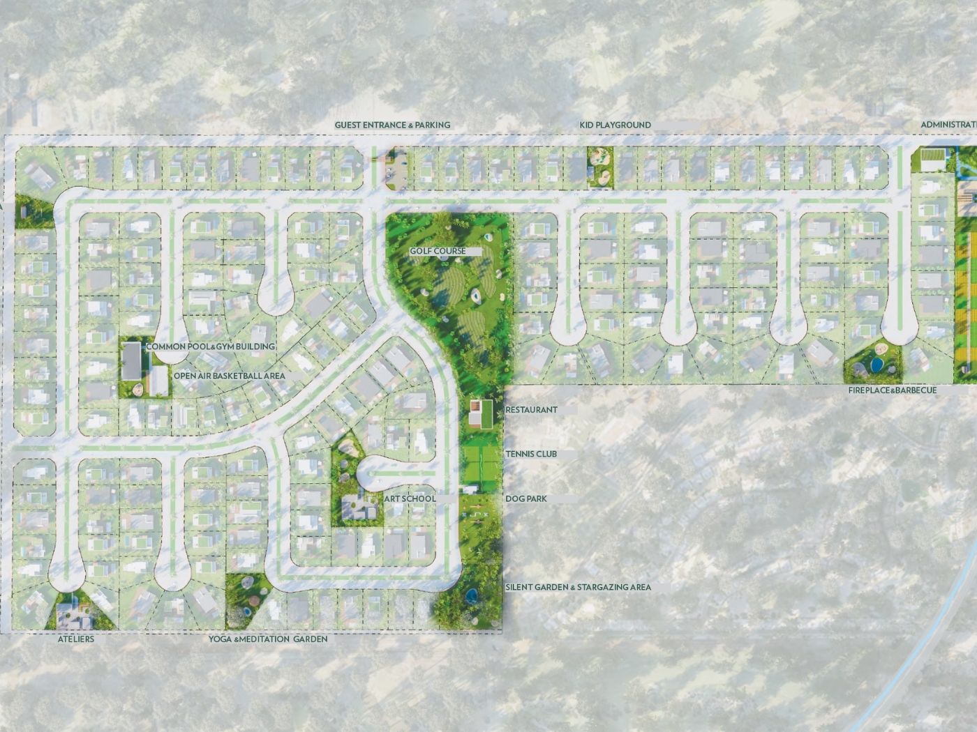
The plan gives as much attention to shared ground as to the homes themselves — sport, quiet, culture, and everyday gathering, each with its own place on the site.
Golf course, tennis club, open-air basketball, beach volleyball, and a common pool and gym building.
A silent garden and stargazing area, a yoga and meditation garden, and hobby gardens for residents.
An art school, artist ateliers, and an open-air cinema.
Restaurant, kid playground, dog park, fireplace and barbecue areas, guest entrance and parking, and an administration office.
A direct link to CV Link, the valley's cross-community cycling and walking route.
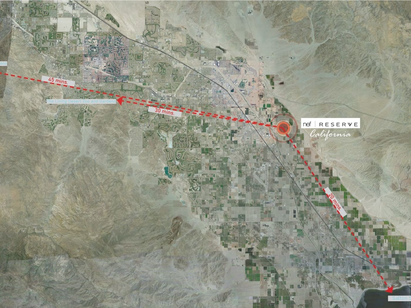
The site sits in the eastern Coachella Valley, within easy reach of the landscape that defines the region.
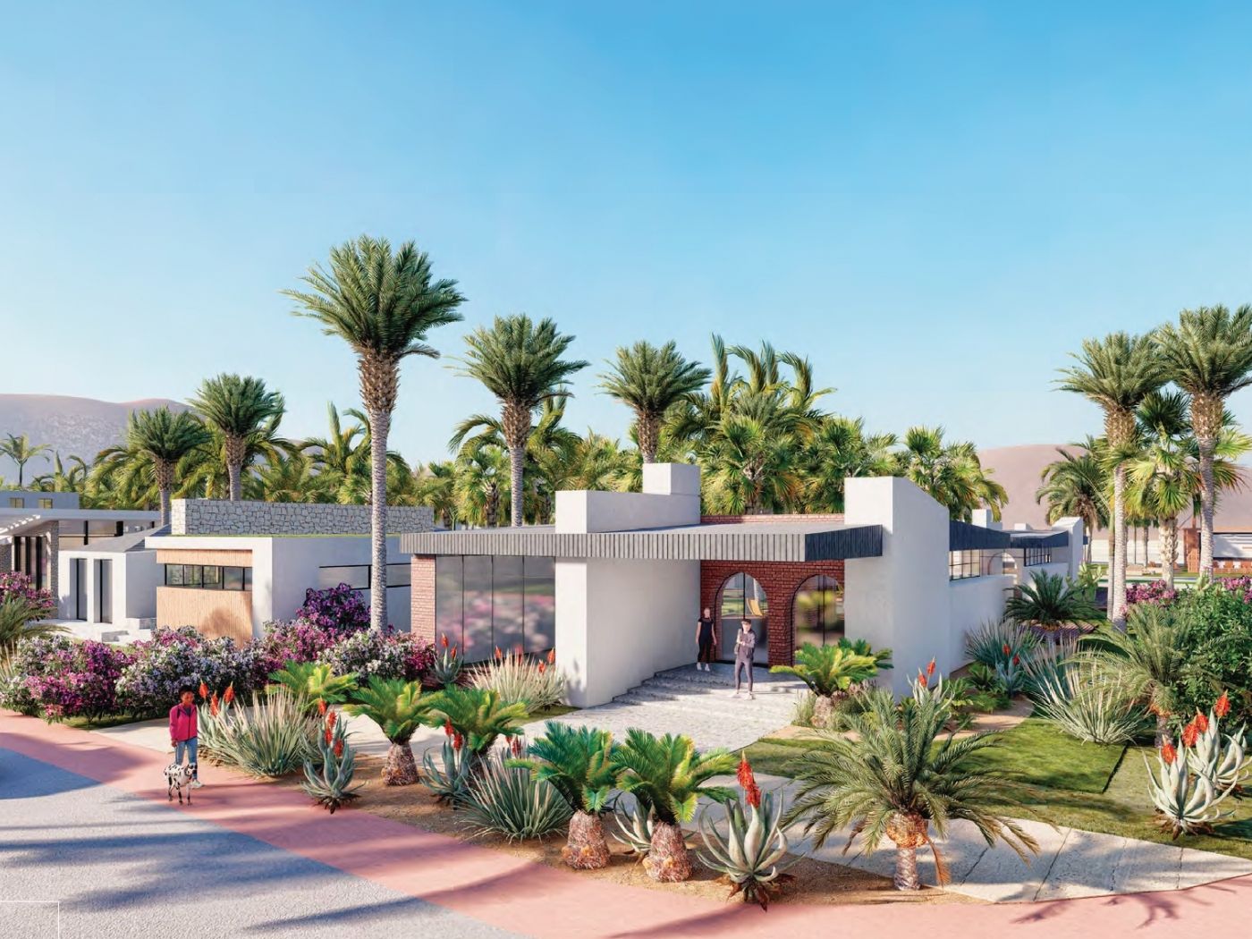
The masterplan mixes villa types with individually designed custom houses, laid out so that most lots back onto green space rather than another property. Streets curve to slow traffic and to give each cluster its own character, and planting is desert-appropriate throughout.
Homes are grouped into neighbourhood clusters, each within walking distance of shared amenities — the intent being a community that works on foot rather than one that depends on the car.
A development at this scale is a permitting exercise before it is a construction one. SDG carries the land development side — due diligence, entitlement, and construction permitting — and then the vertical build, under the same design-build structure we use on a single house.
Due diligence investigations, land use applications, rezoning, variances, and subdivision through to a buildable site.
Environmental review, agency coordination, and construction permitting managed in-house rather than passed to an outside expediter.
Grading, drainage, utilities, and roads — the work beneath the neighbourhood that determines how it lives.
Homes and community buildings delivered by the same team that carried the entitlement.
Boundary survey, aerial topography, easement encumbrance mapping, engineering base and constraints mapping, habitat assessment, biological resources survey, and CEQA documentation are complete.
The roadmap through entitlement and permitting, including the environmental review process and the legal constraints that shape it.
Hydrology, seismology, topography, utilities, water management, and site access — the infrastructure beneath daily life in the neighbourhood.
How the site's constraints and opportunities shape the master plan: individual residences, the community hub, amenities, and the outdoor environment between them.